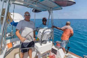
Coral reef management requires a robust understanding of the state of the managed environment. For a long-term management plan to be successful, a monitoring scheme of the coral reefs has to be in place. To start with such a process, an initial survey trip onboard the Blue Whale was conducted to execute a baseline (initial status) survey. Captained by the jack of all trades, Robert Edgar, and with a group of experienced surveyors, including Sefano Katz, the BLI project manager; Muhammad Azmi Abdul Wahab (Zuzu) from the Australian Institute of Marine Science, Australia; and Katrina Bromhall from the Danish Technical University, Denmark (our project collaborators), we had a productive and enjoyable expedition.

The purpose of the trip was to select sites that will be used to monitor the reefs inside and outside traditionally instated marine protected areas—sites that are locally believed to be tabu. Six sites were selected within the Rukua Qoliqoli (fishing grounds), where surveys will be taken now and into the future. This allows us to monitor the changes in the state of the reefs over time. Finding representative sites, with the same depth and structural complexity inside and outside the tabu areas, is essential for making a comparison.

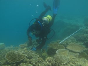
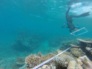
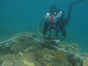
A manta-tow survey (where a surveyor holding a board is pulled with a rope behind a boat) was initially carried out to facilitate the assessment of representative sites over a large area in a short period. Afterwards, a team of divers equipped with hammers, tape measures, and 50 centimeter metal rods descended onto the site in order to mark the surveying sections of the reef. The tape measure was trailed 30 meters along the reef with a metal rod placed at 10 meter intervals. Divers were careful to select spots that were void of living organisms. Each site has three transects with at least 30 meters between them. This makes a permanent survey site that will be revisited and monitored bi-annually.

Once sites were designated, surveys were carried out to create a baseline dataset for the state of the reef. Three divers carried out the surveys, each recording different aspects of the reef. A video-transect recorded the fish present along the surveyed section of reef, scoring their abundance and diversity. The abundance and size of uncommon fish species were recorded separately. Digital images of a half-meter-squared quadrat above the reef substrate documented the benthic composition (the assemblage of living and non-living material on the floor of the reef). A visual census was also carried out by trained specialists, determining the health of the corals. The specialists assessed each individual coral colony and identified the reason for its compromised health.
The composition of uncommon macroinvertebrate species (e.g., sea cucumbers, Trochus snails and urchins) was also documented, scoring their occurrence, abundance, and size.

Continuing to survey the reef in this manner builds up a time series of data that reports the health of the coral reef ecosystem. The crucial baseline information serves as a comparison for the data collected over the years. An abundance of additional facts can be taken from the time series dataset, allowing researchers and village leaders to gauge whether management measures are successful. It will also help them to reassess these measures when necessary. The dataset can also help identify changes in species composition, such as increases in the crown-of-thorns sea star—a voracious coral predator that is believed to indicate excess nutrients in the water.
We are optimistic that this is just the beginning of a successful and prosperous time series, which will later be carried out by trained Champions from Rukua village. The work carried out to date was made possible by Blue Whale Adventures, which let us use the Blue Whale as a research vessel. Its kind donation allowed us to travel between sites, compress air for dive tanks, and to have an office so we could keep up with ongoing data analysis.


